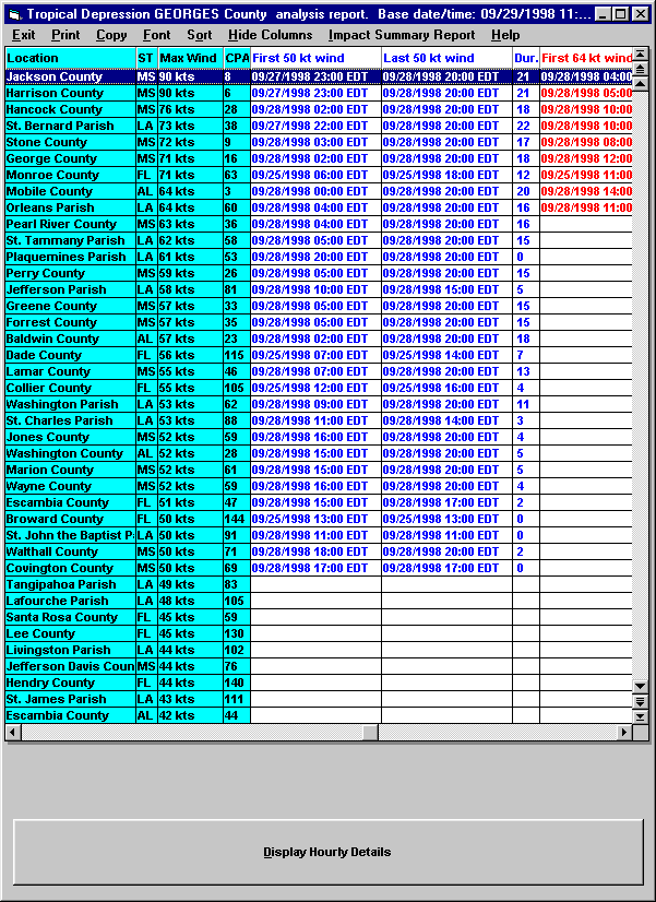
The Actual County Reports consists of a Summary Report, Impact Analysis and a Detailed Analysis. (Actual data is determined using the National Hurricane Center Advisory Information).
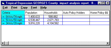
The Impact Analysis report summarizes the information by County to give an indication of the overall impact of the storm. The user is able to establish up to 10 (3 in EM/Pro) additional data fields which are appropriate to their business. In the example below, the Auto Policy and Home Policy information might be of interest to an insurance company.
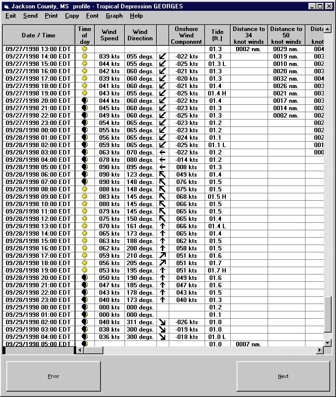
The detailed county report shows additional information on the impact of a storm. It gives an hourly "blow by blow" description of the wind speeds and wind direction as well as other important information. The example below is the forecast for Jackson County, MS with Hurricane Georges.
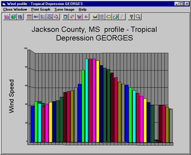
The following is a graph of the wind speeds at Jackson County, MS.
For information on the Coastal Flood Index Report
Copyright ©2007 PC Weather Products, Inc.,
All Rights Reserved.