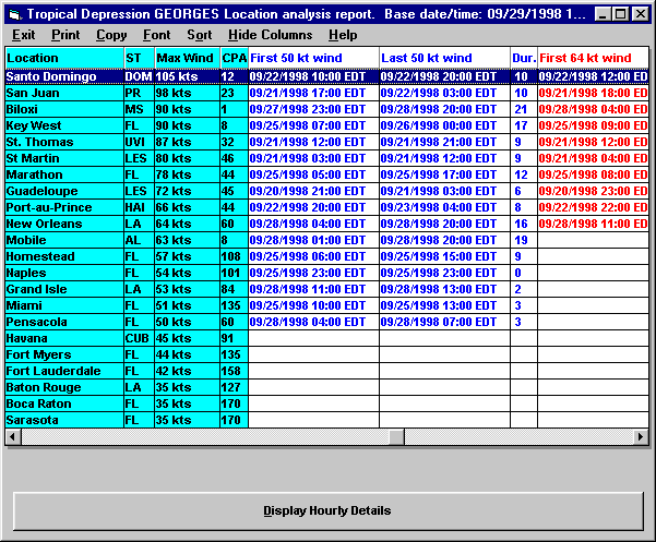
The Actual Location Reports consists of a Summary Report and Detailed Analysis. (Actual data is determined using the National Hurricane Center Advisory Information).
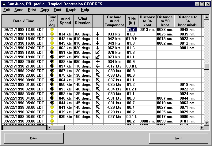
The detailed report shows additional information of the impact of a storm. It gives
an hourly "blow by blow" description of the wind speeds and wind direction as
well as other important information. The example below is for San Juan
with the passage of Hurricane Georges.
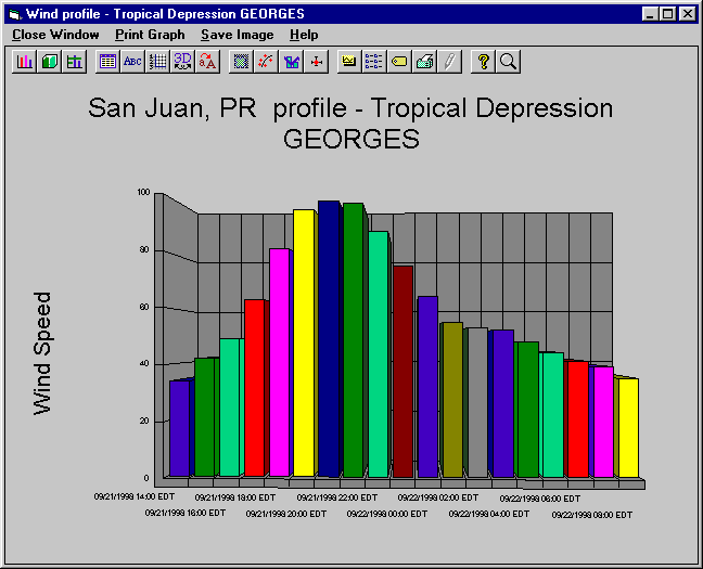
The following is a graph of the wind speeds at San Juan, PR.
For information on the Coastal Flood Index Report
Copyright ©2007 PC Weather Products, Inc., All
Rights Reserved.