Slosh MOM data
(Click here for a description of what SLOSH MOM is)
In the
EM/PRO system, the SLOSH program allows the user to display the "raw" SLOSH
values in the SLOSH MOM sectors. It does NOT show the elevation of the
area being examined so the user would have to utilize elevation data while
viewing the data. A must more elaborate solution is available with
HURRTRAK RM/PRO and
HURRTRAK Advanced with SLOSH
Inundation analysis. Some example of slosh in EMPRO
are shown below.
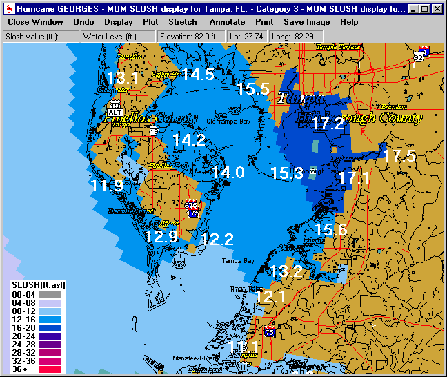
Tampa Bay, Category 3 storm. Values indicate potential
water levels above sea level (ASL)
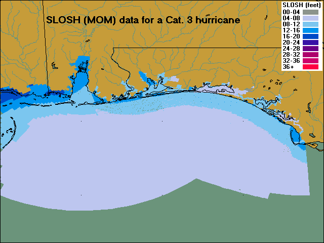
Example of a composite slosh map showing a Cat. 3 hurricane. Both Pensacola and Panama City Basins are plotted.