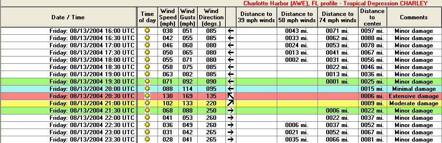
The HURRTRAK systems now (2005) analyze a storm's forecast or actual position at half hour increments instead of every 60 minutes. This can make a huge difference for small and/or fast moving storm's like Hurricane Charley in 2004. The report below shows how a maximum wind estimate of 130 MPH would have been missed at Charlotte Harbor if the storm was only analyzed at the top of the hour.
![]()
Copyright ©2005 PC Weather Products, Inc., All
Rights Reserved.