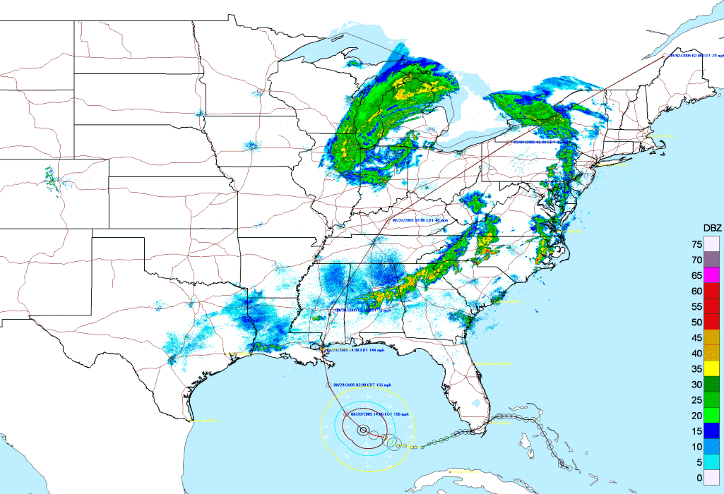
The following shows the National Radar Mosaic image used as a storm tracking map. (image reduced in size by 300%)
Close up of SE USA