County Thematic Maps
The user can now visualize the maximum wind speed expected and forecast rainfall amounts using county thematic type maps.
Below are a series of screens that demonstrate how this function operates...
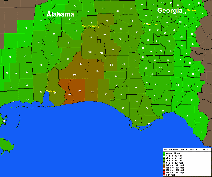
MAXIMUM
WIND SPEED:
While viewing a county summary report
(actual or forecast), the user can select the thematic option whereby the
system will represent the maximum wind speed data on a pan and zoom type county
thematic map.
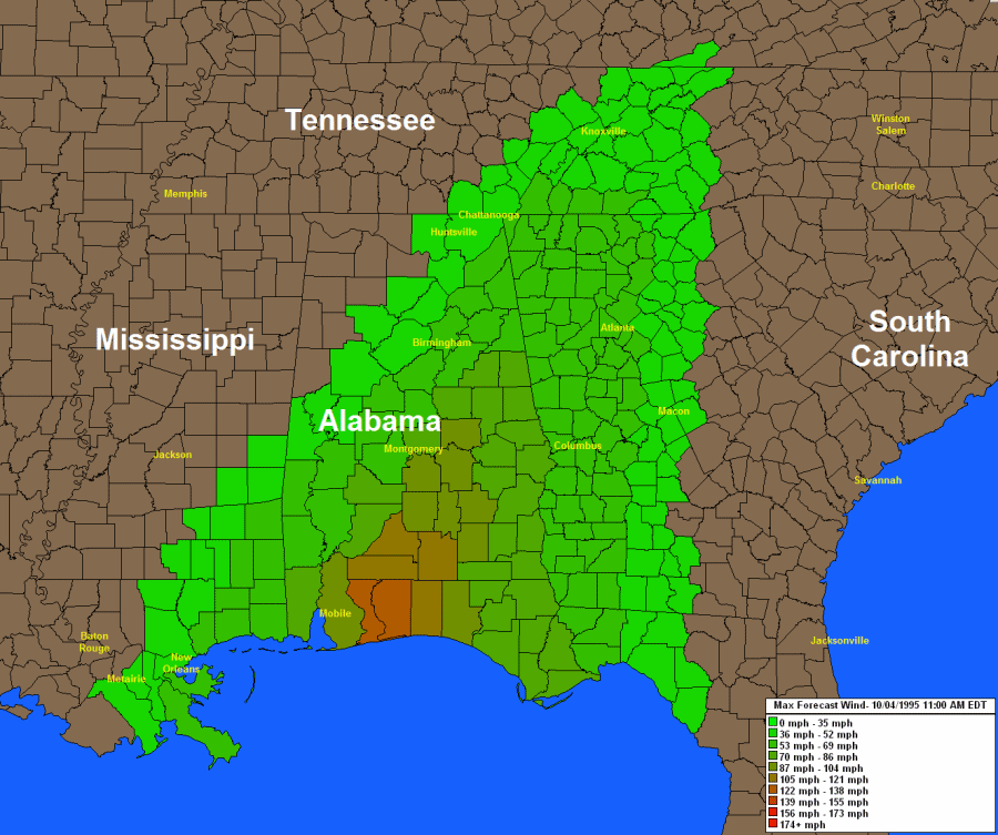
The user can zoom in to show a smaller area and... optionally plot the wind
speed values
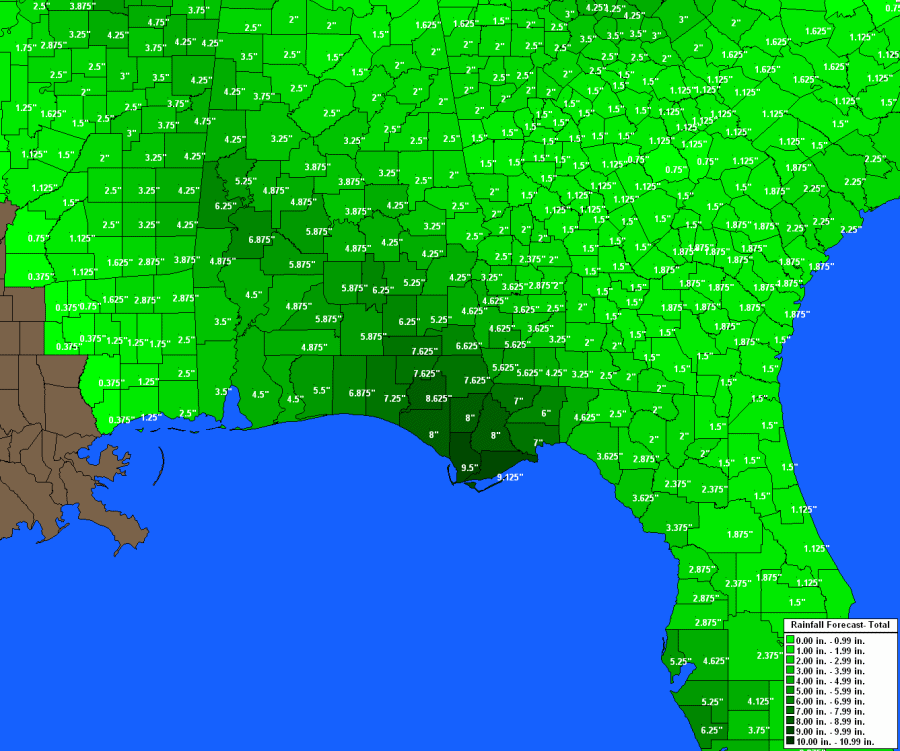
FORECAST
PRECIPITATION:
The user can also choose to display the forecast precipitation (thematic
option). The system will then represent the rainfall forecast on a
pan and zoom type county thematic map.