Astronomical Tide Database
The timing of the astrological tides are, in many locations a critical factor in determining the amount of coastal flooding. The system allows the user to associate a location to any tide prediction point. There are over 20,000 tide prediction points in the database that covers the US East and Gulf coast as well as PR and the USVI.
Below are a series of screens that demonstrate how this function operates..
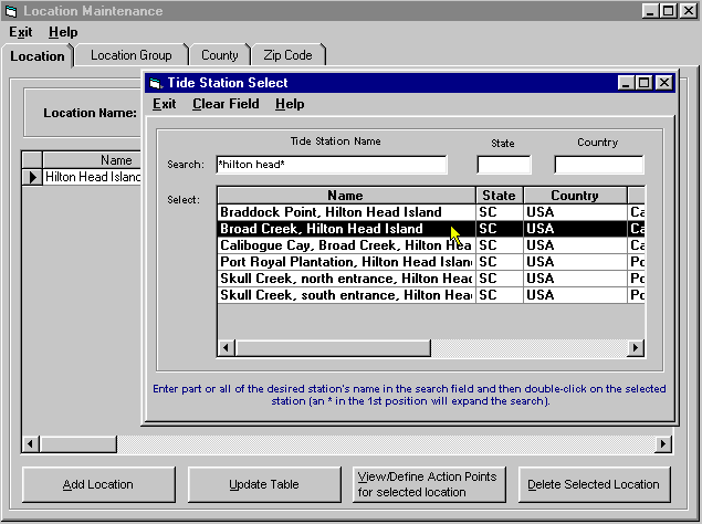
Initially the user associates locations to nearby tide prediction points. In the example below Hilton Head Island is being associated to Broad Creek, Hilton Head Island.

This can be done for as many
locations as needed.
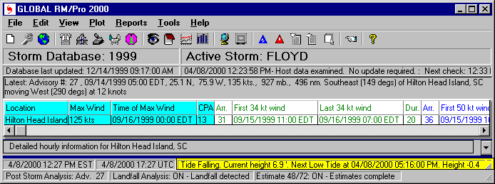
After setting this up, when viewing the tracking program's main screen, the base
location's current tide information is shown on a status bar. (the base
location in this example is Hilton Head, SC)

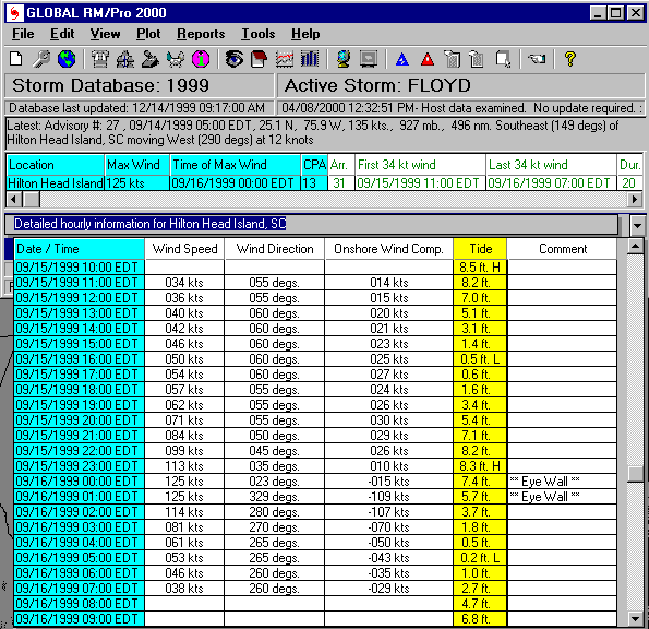
If a storm system is expected to affect the base location in the next 72 hours, the tide information is also displayed on the main screen's hourly impact display.

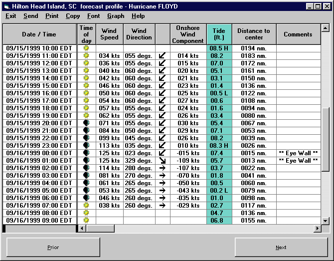
Finally, the tide information appears on the detail impact report... which can
be printed, emailed, exported to HTML, etc.. (Detail reports can be for
any set of locations... not just the "base" location.)

The combination of forecast wind speed, onshore wind component and astronomical tide data is valuable information in determining a storm's potential for causing coastal flooding