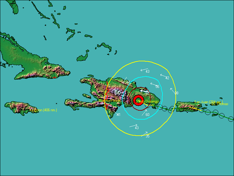
The user has the option of displaying the storm tracking information on a topographical type map. This provides a great visual method of determining the type of terrain that a storm is encountering or forecast to encounter.
The following is an image of Hurricane Georges as it approached Hispaniola. The storm was weakened greatly by the high mountains of the island.