|
2019 HURRTRAK Software
Enhancements...
Click on the item headings
below for more information
(some include video links)
|
 |
"ExpertEase"
– Our highly rated
ExpertEase, will
continue in the 2019
software and includes
all 4 seasons making
it a
year round benefit.
Please note that this
feature is ONLY available to
users who maintain the
current version of the
Hurrtrak software. In order
to continue receiving these
updates, you need to upgrade
to the 2019 software. For
those less familiar with the
feature, ExpertEase is a
superior tool in your data
arsenal. On a
daily basis via
video update, our
chief meteorologist
discusses current tropical
(and now also non-tropical)
conditions as well as what
is likely to occur in the
near term. These
observations are integrated
within the Hurrtrak program
throughout the Atlantic
Hurricane season and also
available via a web browser.
Unique to PC Weather
Product’s portfolio,
ExpertEase gives you
“inside” knowledge of the
factors and conditions
affecting the path and
strength of active tropical
storms as well as the
details on winter storms and
spring severe weather.
Remember, it is available to
all users with current
Hurrtrak software installed.
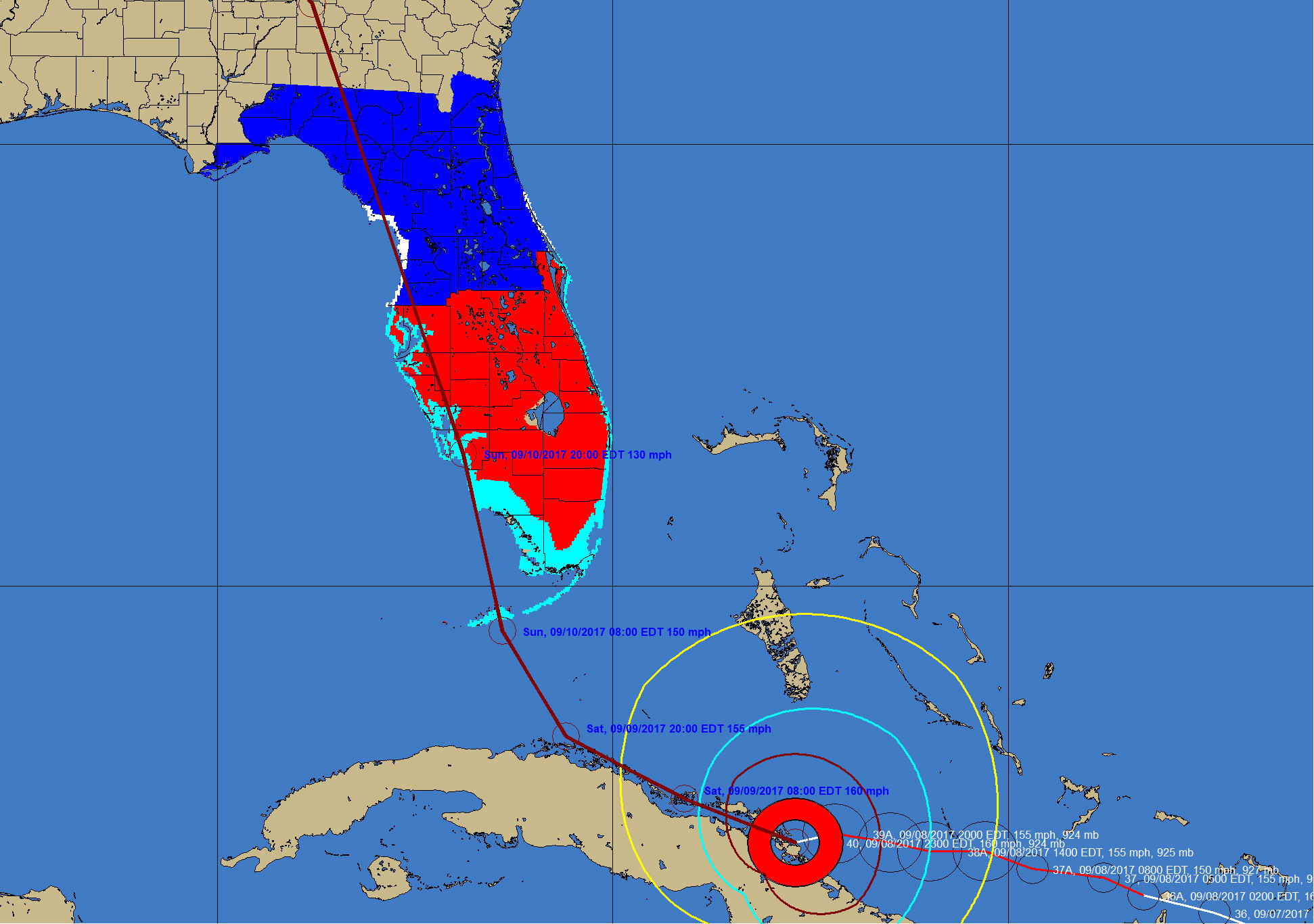
Seven (7) day forecast support
– While the National Hurricane Center is not yet supplying/releasing forecast beyond 5 days… we expect they will within a few years. In anticipation of this we have modified the Hurrtrak system to support forecast positions out to 168 hour (7 days). The good news is while NHC may not be releasing day 6 and 7 forecast yet, you have the option of manually entering extended forecast information (from other sources, such as forecast models) in 2019. This includes utlization of the "what if" capability of the system.
Enhanced What if capabilities – We have enhanced the "What IF" forecast function to allow the user to specify the exact forecast positions, max wind and wind radii at 12, 24, 36, 48, 72, 120, 144 and 168 hour forecast times.
Precipitation Report
– We have introduced a new report thw shows the forecast rainfall totals by location or location group. The report shows the forecast totals for day 1, day 2, day 3, days 1-3, days 1-5 and 1 week.
This
report can be generated 12 months a year, with or without a current storm being active.
Enhanced forecast track depiction
–
Introduced the ability to clearly depict current and prior forecast tracks in different colors.
User Interface improvements – Improved copy and past capabilities for tracking maps and animation frames.
Shape File Export
– We have added the
ability to
export forecast rainfall amount to ESRI shape files.
Enhanced Max Wind Thematic
– We have added more information to the thematic wind display... such as time of max wind, etc..
Hurricane Forecast Wind Estimation improvements
– With concept of
constant improvement... we have continued to
make enhancements to the wind
estimation routines within the system. All of
these changes are "under
the covers" within the program code.
Storm Surge Improvements – Our 2019 release includes
the latest SLOSH basin updates.
Animation interface improvments
– Decision Arc and range ring animation easier.
Miscellaneous
technical and user interface
improvements
-
Several
internal enhancements
to keep up with the changing
security nature of data and
more consistent user
interface methods.
and...
more changes
under development not
yet listed
here... |